


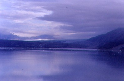
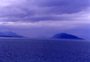
After yesterday's White Pass and Yukon train ride but before I woke up, our ship was met by a pilot boat bringing the Glacier Bay National Park rangers aboard. Once I was up, I went up to the buffet for breakfast and even though the weather was cold and damp, I sat on a deck chair on the Promenade Deck seeing a few whales, as well as a bear on the shore.
Glacier Bay National Park and Preserve is located west of Juneau. President Calvin Coolidge proclaimed the area around Glacier Bay a national monument under the Antiquities Act on February 26, 1925. Subsequent to an expansion of the monument by President Jimmy Carter in 1978, the Alaska National Interest Lands Conservation Act (ANILCA) enlarged the national monument by 817.2 square miles on December 2, 1980, and created Glacier Bay National Park and Preserve. The national preserve encompasses 91.3 square miles of public land to the immediate northwest of the park, protecting a portion of the Alsek River with its fish and wildlife habitats, while allowing sport hunting.
Glacier Bay became part of a binational UNESCO World Heritage Site in 1979 and was inscribed as a Biosphere Reserve in 1986. The National Park Service undertook an obligation to work with Hoonah and Yakutat Tlingit Native American organizations in the management of the protected area in 1994. The park and preserve cover a total of 5,037 square miles with 4,328 square miles being designated as a wilderness area.
The west side of the bay consists of a 26,000 feet thick sequence of Paleozoic sedimentary rocks, mainly massive limestones and argillite. The oldest rocks in this sequence are the Late Silurian Willoughby limestone and the youngest being the Middle Devonian Black Cap limestone. An outcrop west of Tidal Inlet includes a sandstone, graywacke and limestone of unknown age. Sedimentary rocks of unknown age on the east side of Muir Inlet include tuff interbedded with limestone. The rocks exposed on the 1,205 foot high hill called "The Nunatak" have been metamorphosed. Early Cretaceous diorite stocks are exposed south of Tidal Inlet, and on Sebree and Sturgress Islands. Quartz diorite outcrops on Lemesurier Island. A granitic stock is exposed in Dundas Bay. Mafic dikes up to 20 feet in width occur throughout the area.
Glacial advances occurred 7,000, 5,000 and 500 years ago, with the last extending to the entrance of the bay, where it left a huge semicircular terminal moraine. The consequent surface glacial deposits include gravels as outwash and moraines. Glacial gravels extend up to 2,000 feet up the mountain slopes. Lakes have formed where the glaciers have dammed the heads of valleys. Preglacial forests are found east of Goose Cove and on the east side of Muir Inlet.
A molybdenite deposit occurs on The Nunatak in quartz veins associated with a quartz monzonite porphyry, which includes gold at 0.04 ounces per ton, and silver at 7.07 ounces per ton. A copper deposit occurs on Observation Mountain. Quartz veins containing gold are exposed west of Dundas Bay and on Gilbert Island. Placer gold is also found in the bay. A silver deposit was mined on the western portion of Rendu Inlet. The granodiorite and quartz diorite area between Lamplugh Glacier and Reid Glacier contains most of the quartz vein gold lodes, which were produced by six mines. This is known as the Reid Inlet gold area. The Monarch Mines and the Incas Mine was discovered in 1924 by J. Ibach. The Monarch No. 1 and No. 2 veins were drift mined with 200 and 150 foot adits respectively. The LeRoy Mine was the largest though, discovered in 1938 by Gustavus founder and resident A.L. Parker and his son L.F. Parker. They operated a two-stamp mill and an aerial tramway. Most production had ceased by 1945 though.
The region experiences tectonic activity with frequent earthquakes. Earthquake-induced landslides have been significant forces for change, inducing tsunamis. Additionally, parts of the region are undergoing post-glacial rebound (also known as isostatic rebound), the process in which land rises after the weight of the glacier has been removed.
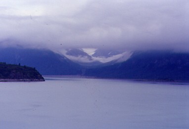
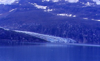
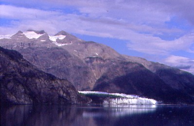
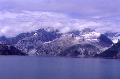
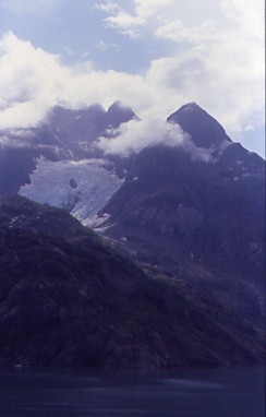
A view up Queen Inlet showed Carroll Glacier high up on the mountain. A terrestrial glacier which, although it receded throughout much of the twentieth century, experienced a surge in the 1980's. Our ship continued up Glacier Bay as the clouds began to lift off the waters.
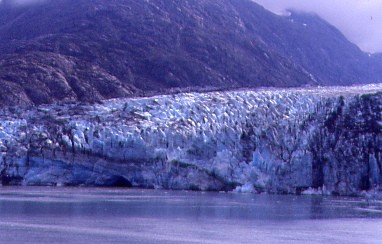
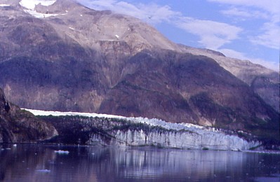
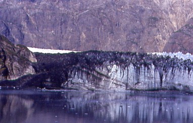
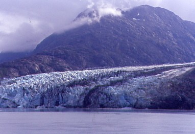
The first tidal glacier we saw was Reid Glacier, which is about three-quarters-of-a-mile wide, 150 feet high and over ten miles long. Like Lamplugh Glacier to the northwest, it originates in the Brady Icefield. The glacier is now fully grounded. Sediment deposited from streams draining out of the glacier on the eastern and western margins is gradually filling the inlet in front of the glacier, the deposits being exposed at low tides. The center of the glacier continues to slowly recede at about 30 to 50 feet per year, while the remainder of the margin has been receding at about 30 feet per year or less while progressively thinning. Crevasses that characterized Reid Glacier within its terminus region since the early 1900's are slowly closing as flow rates decrease and the terminus becomes terrestrial. The glacier filled all of Reid Inlet in 1899 and has slowly receded to its current position since that time. On the walls of the fjord, lateral deposits of the glacier extend from near the waterline up and along the bedrock face, and mark the positions and thickness of the ice at locations where it remained stable for some period of time during this overall period of recession.
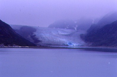
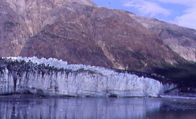
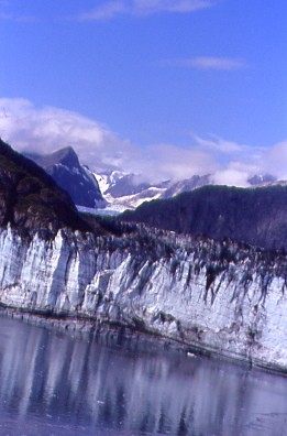
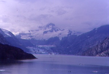
Twenty minutes later, Lamplugh Glacier came into view. This is 0.9 miles wide, 165 feet high at the face and over 19 miles long. Its flow rate is approximately 0.75 - 1 foot per day. Noted for the intense blue colour of its ice, Lamplugh is fed by the Brady Icefield, which lies east of the Fairweather Range. As temperatures warm and snow levels rise, the Brady Icefield accumulation areas appear to be shrinking year after year. The terminus is now grounded, and only at high tides, does saltwater reach the ice face. A large subglacial stream flows from the central part of the terminus, often creating large caves in the face of the glacier. Such subglacial streams discharge large volumes of sediment-rich water into the fjord, filling the small embayment at the ice edge with brown to tan milky water.
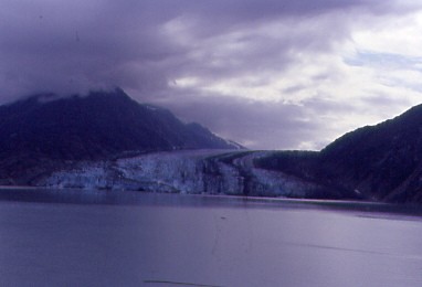
Suddenly the Sun Princess came out of the clouds with blue skies above and in the head of the bay was Grand Pacific Glacier. At 1.35 miles wide at the terminus, with an ice face ranging from 65-165 feet, its length is over 20 miles long. Grand Pacific Glacier's flow rate is approximately 0.5-1 foot per day, according to satellite data. The glacier last joined the edge of Margerie Glacier in 1992, but these glaciers are no longer together due to the recession of Grand Pacific. A small stream presently flows between the two termini. Unlike Margerie, Grand Pacific is now grounded and does not have a dramatic ice front. Behind the terminus, the ice may thicken to 900 feet or more, although evidence shows the ice has been thinning over the last several decades. The western two-thirds of the ice front originated from the tributary Ferris Glacier, but more recently, Landsat imagery has shown that a meltwater stream now separates Grand Pacific from Ferris Glacier. Therefore, nearly all of the ice in the ice front is now from Ferris Glacier. The Ferris Glacier contains a huge amount of rock and dirt that it has removed from nearby mountainsides, giving the ice its brown or 'dirty' appearance.
As we moved closer to the Grand Pacific Glacier, Margerie Glacier came into view.
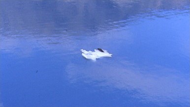
Nearing the glaciers, I spotted a bay seal out on an iceberg. As the ship neared the seal, it dove into the safety of the water.
Margerie Glacier is an icy highlight of any visit to Glacier Bay National Park, and a primary destination for visitors on sailboats, kayaks, tourboats and cruise ships. It is about 0.85 miles wide, with an ice face that is about 200 feet high above the waterline. The glacier is about 21 miles long and begins in snow-fields in the Fairweather Range where elevations exceed 9,000 feet. The ice flows about 3-7 feet per day. Margerie Glacier last joined Grand Pacific Glacier in 1992, but they have since separated as Grand Pacific recedes. Margerie's terminus was relatively stable in position through the 1990s; however, about 1998, the northern third of the terminus began a slight recession, forming a small embayment within the ice face. Over the years, this part of the terminus has thinned and the embayment has expanded.
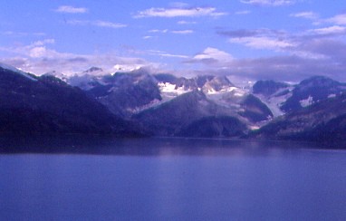
Mount Quincy Adams came into view out of the clouds. After spending a thirty minute stop at Margerie Glacier, the Sun Princess turned and proceeded down Tarr Inlet of Glacier Bay. I went and checked my e-mail and when finished, noticed the ship was turning up John Hopkins Inlet.
That took us by Lamplugh Glacier up this channel.
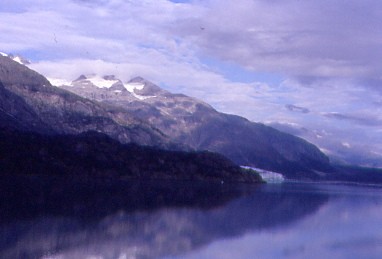
The view ahead of our cruise ship.
We came to the point where John Hopkins Inlet turned southwest, giving everyone a beautiful view of John Hopkins Glacier. This tidewater glacier is about one mile wide and 225-300 feet high at the terminus. It is formed from numerous tributary glaciers, many of which extend twelve or more miles into the surrounding peaks. About 50 medial moraines develop from the joining of these tributary glaciers. The debris in these moraines can be seen in the ice face and extending up-glacier as prominent black bands. This debris is transported in and on the ice and released either by melting of the ice face or calving of icebergs into Johns Hopkins Inlet. Of note, Johns Hopkins is characterized by submarine calving - calving below the water surface caused by breaking off of ice from an "ice foot" that extends from the basal part of the glacier. These "basal bergs" rise suddenly and unexpectedly, emerging, sometimes explosively, without warning at the water surface. Melt-water from the glacier is discharged from submarine tunnels or conduits located near both the eastern and western edges of the glacier. Sometimes this water emerges at the inlet surface as fountains. Black-legged kittiwakes are commonly seen diving, floating and feeding where the meltwater upwells along the ice face.
The glacier flowed down the main valley at about 3,000 feet per year, or about eight feet per day, according to observations made in the late 1970’s by S. Brown and others. Today, Johns Hopkins Glacier's flow rate is approximately 5-12 feet per day according to ITS_LIVE satellite data.
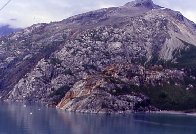
Rocks here formed by the forces of plate tectonics, creating a colourful scene.
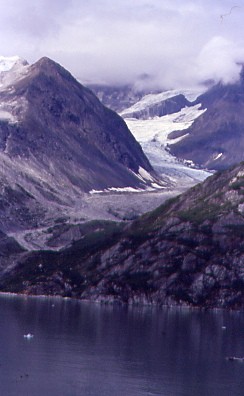
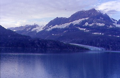
The view up another valley with a glacier at the summit.
Mount Cooper stood out to the south.
The Sun Princess passed near Lamplugh Glacier.
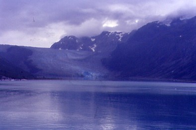
The last tidal glacier we passed on our way back out was Reid Glacier. The weather turned wet again and I relaxed in the room as I had seen everything on our journey this morning.
Later I went up two decks to the Promenade for our departure from Glacier Bay.
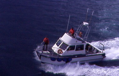
As I walked to the rear of the Sun Princess, the pilot boat came to pick up the rangers. Back in the room, we lost the ESPN signal and now had four channels of the same BBC program, which was disappointing to my mother as she had wanted to watch USC football. I relaxed a little more before going to the front of the Lido Deck.
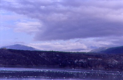
Our ship passed Idaho Inlet while we cruised west from the Icy Straits to Cross Sound before the rain came.
The north end of Chichagot Island as we arrived at Cross Sound. Our ship passed Cape Spencer Lighthouse and we went out into the Gulf of Alaska then I returned to the room finding my mother watching "Under A Tuscan Sun". I suggested that she should try ESPN again and there was USC playing Virginia Tech. USC won the game 21-10.

I had to dress for dinner as it was Formal Night and had my usual steak. After I checked Sports Center, I called it a night.


