TrainWeb.org Facebook Page
Union Pacific Railroad Bridge, Riverside, California

Union Pacific Railroad Bridge, Riverside, California

Photos by Carl Morrison, Carl@TrainWeb.com

IMG_1427x.jpg

One of Chris Guenzler's photographs in the Silver Rails Gallery Opening in La Plata, MO, is labeled, "Santa Ana River Bridge."  I knew the local river, in Orange Country, California, is called the Santa Ana River, but I thought the bridge must be on some other Santa Ana River, maybe in Spain or Eastern US, based on its architecture.  As it turned out, it is the same local river, but in the next county to the east, Riverside County.

Chris called and said he was on the Metrolink that crosses that bridge and asked if I'd like to go with him the following day to photograph it with whatever freight traffic might be passing plus the Metrolink he was on at the time since he knew the time it crossed the bridge.

I picked up my GPS (Guenzler Positioning System) at his house, and we headed to Riverside County.  To use your GPS, locate the Anza Narrows Park, Riverside, or enter its address:  5687 Jurupa Ave Riverside, California 92504.  It costs $5 for a day pass for your group and vehicle.  Drive all the way to the south end of the Park and you will see the bridge.  Walk down the hill to the paved path that goes under the bridge, then climb the hill on the south side of the bridge for a view like you see in my photos below.

The Union Pacific Railroad Bridge (aka Santa Ana River Viaduct) in Riverside, California is an arch railroad bridge, built 1904, spanning the Santa Ana River. Located near the Martha McLean-Anza Narrows Park off Jurupa Ave. on the south side of the Santa Ana River.
--Reference:  http://www.kentalley.com/kbt_photoblog/index.php?showimage=10


( Double-click any photo for a double-sized copy;  Click BACK to return to this page. )


IMG_1459.jpg
Park near this monument, and you will see the trail leading to the bridge.
IMG_1461.jpg

A closer look at the river, trail, and bridge.
IMG_1460.jpg
History buffs will find this placque commemorating an event 130 years before the bridge was built.
IMG_1458.jpg
View from under the bridge at river level.

IMG_1437.jpg
GPS positioned for the eastbound Metrolink.
IMG_1438.jpg
I liked the saying on Chris' shirt.
IMG_1448.jpg

IMG_1450.jpg


IMG_1427.jpg
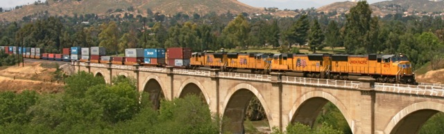
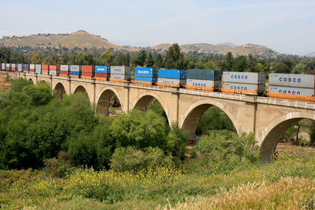
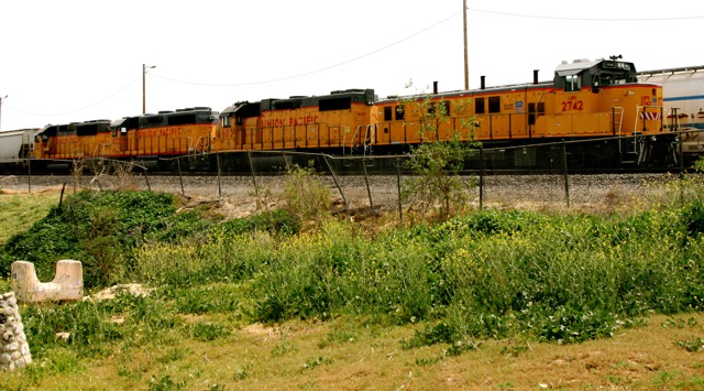
Previous to shooting the Metrolink, from a higher vantage point, we shot a UP freight.
IMG_1430.jpg
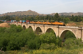
There are 9 or 10 arches and two double-stack cars fit on each arch, so you can get an approximate length to the bridge.


IMG_1434.jpg

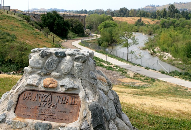
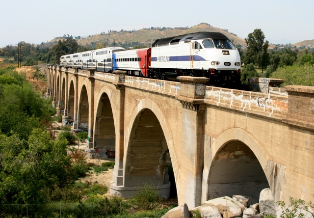
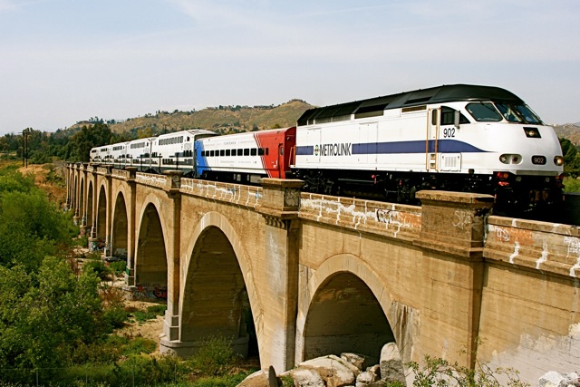
Power resting just east of the bridge.
IMG_1426.jpg
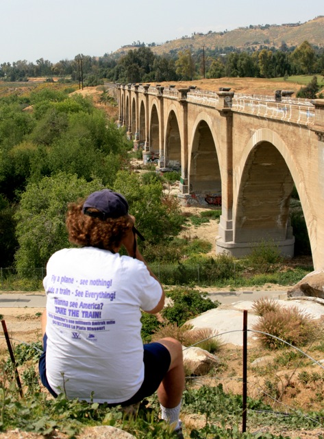
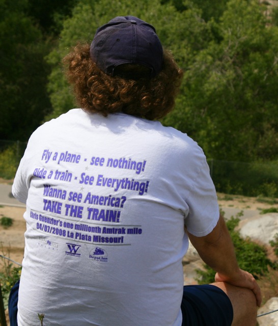
Chris had spotted this loco. on his earlier Metrolink run along this route on Mission Ave.
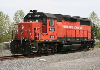
The Palouse River & Coulee City Railroad (PCC) office is located in Lewiston, Idaho. PCC locomotives (above, right) haul approximately 4,000 car loads of wheat, lentils and barley over 202 mainline miles of beautiful rolling hills known as Washington’s "Palouse" region.

The PCC is comprised of three branch lines: the Hooper line that runs from Hooper Junction to Colfax, WA; the Pleasant Valley line that runs from Winona Junction to Thornton, WA; and the South Subdivision that runs from Wallula to Walla Walla, WA; Walla Walla, WA to Dayton, WA , and Walla Walla, WA to Weston, OR. As with all Watco Railroads, the PCC is fully committed to providing its customers an efficient and effective service, providing a fast and reliable delivery and collection of railcars.

--From:  http://www.watcocompanies.com/Railroads/blmr_pcc/blmr_pcc.htm

Hope you enjoyed this photo essay, see my other Photo Essays, Trip Reports, and Conference Notes at:   http://trainweb.org/carl.

See other train photographs (and other Outdoor Photographs) for viewing and sale at: