


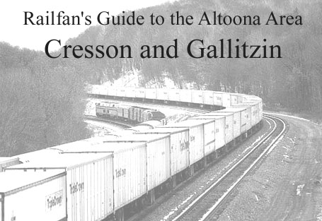
Overview
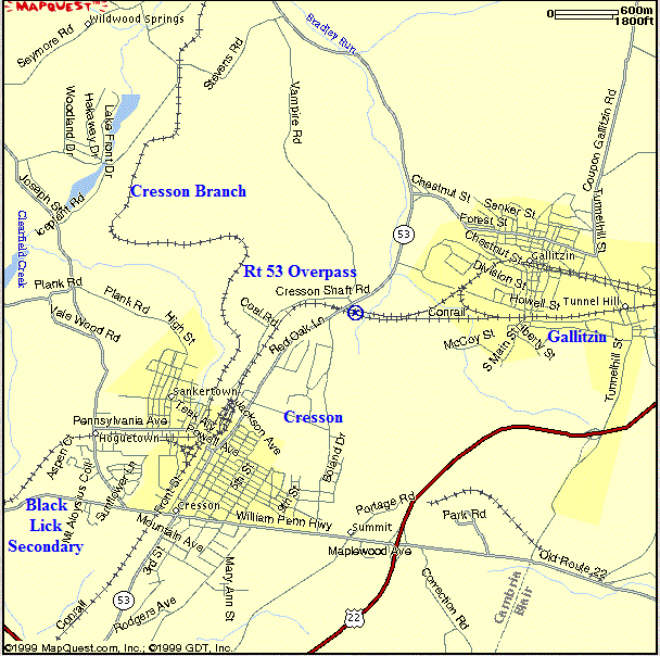
Overview Map of Gallitzin and Cresson
Directions
Directions to Gallitzin From the Altoona Railroaders Memorial Museum
Turn right onto 9th Ave and proceed to 17th Street. Turn right at 17th Street, get into the left lane (DO NOT GO OVER THE BRIDGE) and take the first left (Margaret Avenue). Proceed straight, go over the grade crossing to the light. Continue to go straight (you are on Broad Avenue, a two lane - one way street). Stay in the right lane. When you reach the light at 31st street, proceed through the light and bear right (you are now on a two way street). Follow Broad Avenue to the stop sign at 40th street, which is PA-4008. Turn right and just keep going. After four miles you will reach the visitors center.
Directions to Horseshoe Curve from Gallitzin:
Take Tunnel Hill Street East to Glen White Road. Turn Right. Travel on Glen White Road, go past the old Coke ovens to your left, go through the tunnel and turn left.
Directions to the Allegheny Portage Railroad National Historic Site from Gallitzin:
To get to the Allegheny Portage Railroad National Historic Site, follow Tunnel Hill Street south, and cross over Rt 22.
Directions to Cresson from Gallitzin:
To get to Cresson, go South on Tunnel Hill Street to Rt 22 and turn right or go west on Chestnut St to PA Rt53 and turn left.
Horseshoe Curve to Gallitzin
Bennington Curve
Benny Crew
"Its 1974, ("m3ohwell") and the Benny beer gang are at Bennington curve on Penn-Central's Pittsburg division as an eastbound winds down the hill towards Altoona."
From "m3ohwell's" 8mm movie film, re mastered by JP Media of Ashley, PA. Edited by OH WELL PRODUCTIONS.
Ed K. Laurel Run, PA.PC Bennington
"(m3ohwell) at Penn-Central's Bennington Curve Pittsburgh Division. Four Alco struggling up hill with a westbound."
m3ohwell; Ed K. OH WELL PRODUCTIONSThe Slide // New Portage Tunnel
Amtrak Three Rivers Down Slide
From New Portage Tunnel
"April 22, 2010 - a view of an eastbound freight exiting the New Portage Tunnel enroute to Altoona via Bennington Curve and Horseshoe Curve. Note the track cars eastbound on track 3."
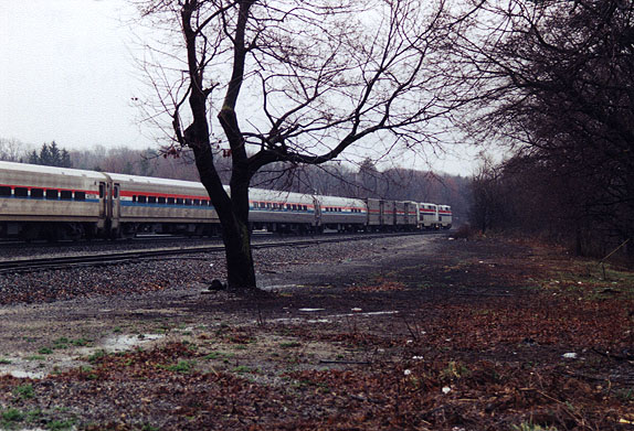
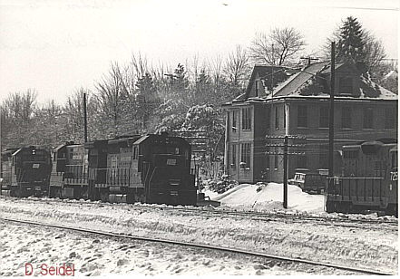
(by David Seidel)March 1998-Eastbound at Gallitzin
"A Conrail eastbound is seen exiting the east side of the Portage tunnel, over the former New Portage Secondary, and proceeding down the slide."
Nysw3004March 1998, Gallitzin, PA - eastbound on the slide
"The eastbound continues down the slide,and pushers emerge from the Portage tunnel on the rear of the train"
Nysw3004Gallitzin
Norfolk Southern Office Car Train - Oct 27, 2009
"The NS Office Car Train has just completed the loop train from UN and AR interlockings at Gallitzin, PA, reversing power-ends."
(by David Seidel)Norfolk Southern Executive Train
"Norfolk Southern's "Office Car Special" exits the Gallitzin Tunnel on Sunday, July 5, 2009 westbound. Although not on this clip, the train departed the mainline at UN (just out of view) and entered the loop track to AR interlocking, returning eastbound to Altoona"
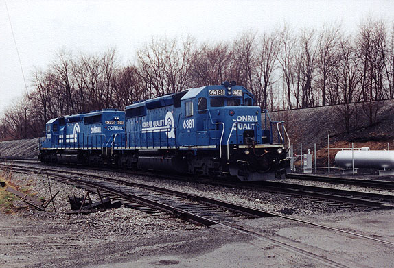
(by David Seidel)PC AR
"From (m3ohwell's) old 8mm movie archives, (excuse the poor quality) A pair of Alco's assist a heavy coal train eastbound at the former PRR. AR tower. Its 1973 which brings us to Penn-Central era."
Ed K. OH WELL PRODUCTIONSThe mountain 1974
"From (m3ohwell's) It's now October 1974 as we railroad the Penn -- Central in the Tunnel Hill, Gallitzin, Cresson, PA area. Alco's were still in service, The GE's were in the minority as well. Back then one was able to camp at "Benny" all weekend without fear of the RR police, and it looked like a railroad not the weed overgrown sanitized propriety its become! Ed K. OH WELL PRODUCTIONS www.dieselairhorns.com"
Ed K. OH WELL PRODUCTIONSGallitzin Tunnels: East Portals! Part 4
"On December 30, 2008, my friend Matt (CSX2788) and I continued our day of railfanning at the west portal of the Gallitzin Tunnels in Gallitzin, Pennsylvania. After seeing nothing in a half hour, we decided to move of to Horseshoe Curve, however, we didn't make it to the curve because on the way to the tunnels I spotted a way to get down to the east portals! So, we decided to go there and you will see in this video what we saw. There are a few more videos in this series, so please check them out to view our entire stay at the Station Inn Bed and Breakfast.
OhioRailsMileposts:
6. Horseshoe Curve; MP 242; Horseshoe Curve Visitors Center; The former Kittanning Point Station is located at milepost 240.9. The station is long gone but a signal tower marks its location. Note: See photos of PRR K-4s #1361 being removed from the curve in the K-4 Restoration Page.
Further information on the Horseshoe Curve can be viewed HERE.
8. Whipoorwill Straight Line; MP 243
9. McCann's Curve
10. MG Tower, milepost 243.5, was built for the purpose of assisting with the volume of war time traffic during World War II. Currently, it is only used when crossovers are operated for track maintenance. The existing tower is scheduled for demolition in the near future.
Further information on the MG Tower can be viewed HERE.
Maps of "MG" Interlocking are Available Here.
11. MP 244, AG Curve
Further information on the AG Curve can be viewed HERE.
12. Greenough Curve
13. Brandimarte Curve
14. Allegrippus Curve
15. Cold Curve
16. MP 246
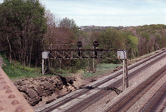
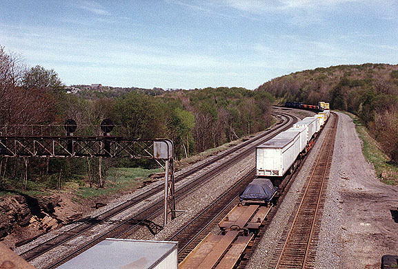
17. "BN" Interlocking & Bennington Curve (A Map of "BN" Interlocking is Available Here.)
View Tom Lynam's 1947 Red Arrow Wreck Photos (NOTE: Tom's pages have been taken off line but can still be found via the Internet Archive Wayback Machine.)
NEW BOOK ON PRR HISTORY: "The Wreck of the Red Arrow: An American Train Tragedy" Author Dennis P. McIlnay: Dr. McIlnay has penned another segment of local history chronicling this tragic event in Pennsylvania Railroad and Altoona Area history. While many students of Pennsylvania Railroad history are familiar with this event of February 18, 1947, and online informational reports are available about it, this major disaster has never been documented in literary form. The Wreck of the Red Arrow follows Dr. McIlnays previous work "The Horseshoe Curve Sabotage and Subversion in the Railroad City", also chronicling a chapter in the Pennsylvania Railroads history associated with Altoona, PA. We recommend these two works by Dennis P. McIlnay as important studies of these two segments of the PRRs history near Altoona, PA, a city founded by the Pennsylvania Railroad. The book follows the circumstances leading to this tragic accident as well as following up on factual reporting of the day, with detailed research on how the tragedy impacted the lives of those most affected, the passengers and their families. Its a must have for your railroad library. The book is available at all Altoona area book retailers for $24.95 and is also available via www.SevenOaksPress.com, and toll free: 866.695.5960. **Note: As of March 2017, the publisher reports both of these books are sold out.
Gallitzin
19a. Gallitzin Tunnel (east end)
19a. Allegheny Tunnel (east end)
20. New Portage Tunnel (east end)
21. New Portage Branch (out of service...track removed)
A Map of the "SF" Interlocking / New Portage interchange is available here.
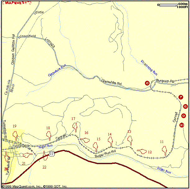
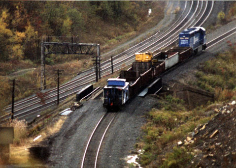
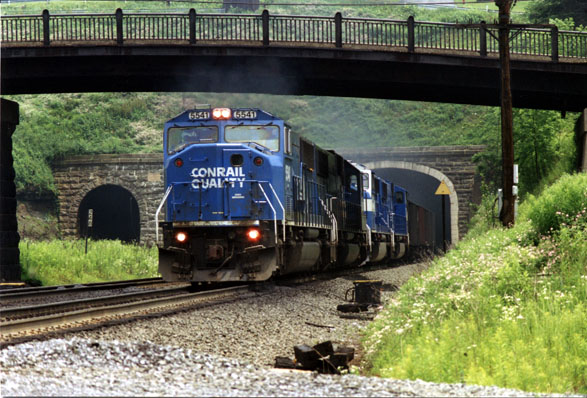
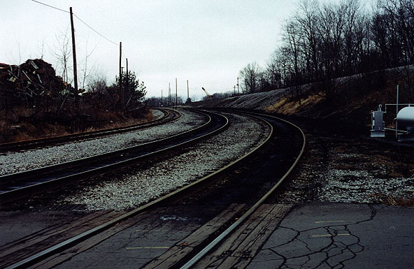
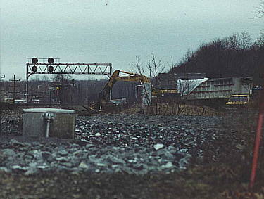
22. The "Slide"; MP 247: "The "slide" down the east slope does not begin until the east portal of the "Portage" tunnel. The slope through the "Portage" tunnel is only -1.37%, less than the ruling 1.7% of the westbound tracks. As the tracks exit the east portal and proceed over the "jump over" or "fly over" of the "New Portage Secondary" the grade eastbound becomes 2.37% and remains that steep until the Bennington Curves." Maximum speed here is 12 MPH. Bill Nelson contributed.
In this telephoto lens photo, you can see a work train backing westbound towards the railroad east end of the New Portage Tunnel. Also visible is the fly-over for the former New Portage Branch. Date: Maps of Gallitzin
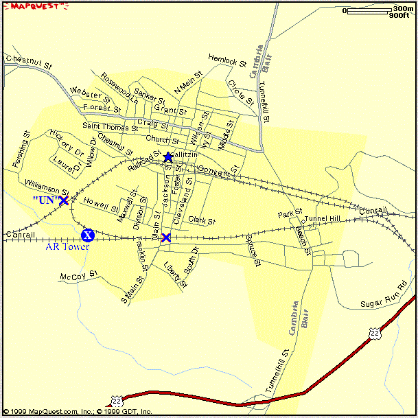
Maps of BN, SF, UN, and AR Interlockings are Available Here.
Location
Tunnel Hill and Gallitzin are located at approximately milepost 248.0. The towns are located within about a mile of each other and it may appear that it is one town. Tunnel Hill is located near the New Portage Tunnel / AR tower. Gallitzin is located near the Allegheny and Gallitzin Tunnels.
History
Gallitzin was a coal mining and coke manufacturing town with large Irish and later Italian populations. It was named for Prince Gallitzin, a priest of a noble Russian family who settled in Loretto, PA (Cambria County) in 1789. Prince Gallitzin was the first Catholic bishop to serve in this part of PA. This is the highest point on the main line at 2192 feet above sea level.
In 1848-49, the Pennsylvania Railroad laid out and adopted the Sugar Gap Route which was the beginning of industrial development at the top of the Alleghenies.
The mountains' extremely high grade made it necessary to build tunnels through the mountain. In 1850, at a cost of one half of a million dollars, the E. Rutter & Sons firm was hired to do the job. Using picks and shovels, it took over three hundred immigrants to complete it.
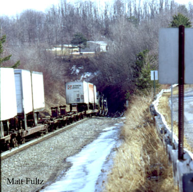
The first tunnel, a bit shorter than the "Twin Tunnels" is situated under Tunnel Hill, PA. It is known as the Portage Tunnel.
Eastbound into the New Portage Tunnel, (west end) Tunnelhill, PA. Date Unknown. Photo by Matt Fultz;
Westbound Work Crew Train...Looking (railroad) west towards the Main Street Bridge (06/26/1998)
The second tunnel, first of the "twin tunnels", is known as the Allegheny Tunnel and was completed in 1854. The third tunnel was begun in 1902 and was completed in 1904. This is known as the Gallitzin Tunnel. There is a magnificent view of this amazing architectural accomplishment from the Jackson St bridge. These tunnels are the highest and longest tunnels on what was once the Pennsylvania Railroad. They are 3605 feet long and at an elevation of 2167 feet.
The first of the "Twin Tunnels" completed the railroad west, after passing around the Horseshoe Curve. This factor made the tunnels so important that they were guarded by Pennsylvania Railroad Police during the war years.
Looking railroad west from on top of the west end of the Allegheny and Gallitzin Tunnels. Date: ?
Westbound Freight rounding the curve over Chestnut Street. Looking railroad west. (6/26/98) A Conrail Coal Train emerging from the West end of the Allegheny Tunnel. Looking railroad east. (06/26/1998) In July of 1902, a blast set off near the tunnels showered the central part of town with large stones, killing one person and injuring another. The building of the second twin tunnel caused the school directly above the tunnels to weaken and a new school had to be built. The new school was completed in 1906. The tunnels remained unchanged until June, 1994.
The Conrail Pennsylvania Clearance Improvement Project began on June 20, 1994. This project consisted of modifying the Allegheny Tunnel in an effort to lower the track and give clearance for the higher, double stack trains. The work used much more sophisticated equipment than a pick and shovel and the crew consisted of about 90 people. "While work was progressing on Allegheny Tunnel, westbound and eastbound trains used Gallitzin Tunnel; its track had been connected to track 2 just east of UN inter-locking, and since track two is signaled both ways, some of the eastbound traffic was able to use Gallitzin Tunnel. It wasn't until Allegheny Tunnel was placed in service that the other one was taken out of service. Thanks again, and feel free to contact me if I may be of further assistance. "(Phil Faudi) After the improvements, the Gallitzin tunnel was taken out of service. The track was subsequently removed.
Trains run through the tunnels 24 hours a day. A map of both tunnels is available here.
July. 11,1949...A PRR. diesel train fueling up in Gallitzin
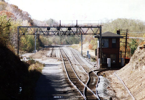
"UN" / "AR" Interlocking is at Milepost 248.4.
Typically, helper locomotives were cut off trains at Gallitzin and operated over the loop track to head back to Altoona.
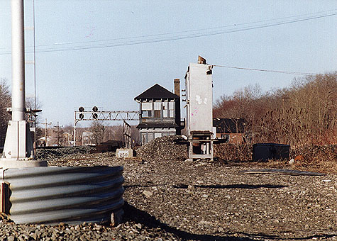
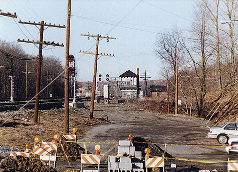
"AR" Tower was closed in 1995 as operations were controlled remotely from Harrisburg, PA
A westbound view of "AR" Tower from the Main Street Bridge; Fall 1996
The old right of way for the New Portage Secondary (at "SF" interlocking", milepost 247.2) was the alternate route over the Mule Shoe Curve to Hollidaysburg, PA. The track was removed in 1984. A Map of the "SF" Interlocking / New Portage interchange is Available Here.
- The "Lilly" detector is located at Milepost 253.1 (Carney's Crossing). There is a dragging equipment detector and a hot box detector.
While visiting the tunnels, stop by the "Tunnels Park" (operated by the Gallitzin Area Tourist Council, 702 Jackson Street, Gallitzin, PA 16641; phone: 814-886-8871). The park is staffed by volunteers and is open to the pubic daily.
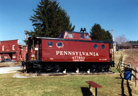
1942 PRR N5C Caboose at the Gallitzin Tunnel Park (04-1996) The park, adjacent to the Gallitzin Tunnels, exhibits a restored 1942 PRR N5C caboose. The caboose has been restored to its original 1942 condition where visitors can see the sleeping quarters, eating area, old fashioned pot bellied cooking and heating stove, various antiques and news stories, and walk on to the cupola observation post.
Erculiani's Dinners opened in 1906
(by kirkleidyassociates)
Forest Zoo in Gallitzin, Pa
(by sportrider24 )Mileposts:
Cresson
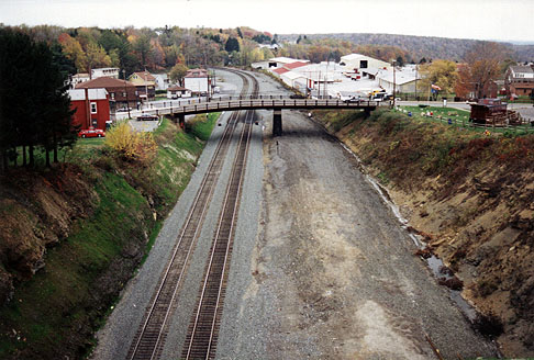
Map of Cresson
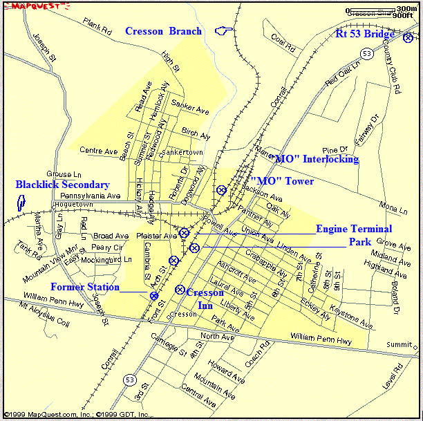
Note: The "X's" on the maps above indicate good viewing locations.
Cresson
NS F Units - Altoona and Cresson
"A video-slideshow of the NS F units as they went from Altoona to Cresson for servicing prior to an OCS trip to the Masters Golf Tournament in Georgia."
By David Williams (March 31, 2010 )PC Flyover Cresson
"Penn Central days at Cresson, PA. The flyover, as an eastbound coal train traverses. This location is a little east of the Station Inn where many of us have stayed. These days the "flyover" is gone, as well as some of the GP 40's, Not to mention the Penn Central."
m3ohwell
March 1998 - Gallitzin to Cresson, PA
March 1998 - Gallitzin to Cresson, PA
NORFOLK SOUTHERN CRESSON PA 2-12-2010
The first settler, Ignatus Adams, a Revolutionary war veteran, was granted a tract of land by the federal government. His land was the first stage link on "the Pike" between Philadelphia and Pittsburgh. Jacob Troxel was one of many settlers and established the first Inn. That Inn was bought by Dr. Robert Jackson in 1830 and capitalized on the naturally healthful and invigorating atmosphere of the mountains. His friend, John Elliot Cresson recognized the potential of the area as a resort and thriving town that attracted industry. Jackson named the settlement in Cresson's memory. Cresson, PA gained its notoriety due to its reputation as being the playground of the affluent and powerful. It became a popular and prestigious health and recreational resort when its springs were discovered to have medicinal value and holiday seekers discovered the "pure mountain air." Wealthy business men such as Andrew Carnegie built his summer home near here. President Benjamin Harrison vacationed here.
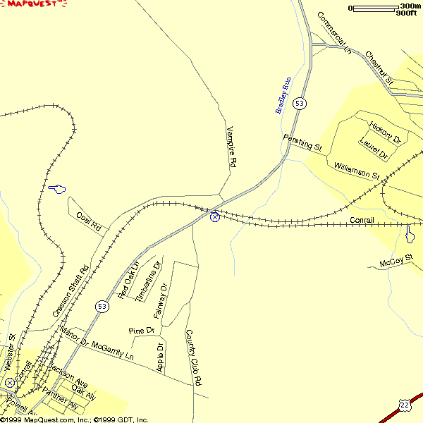
When you get to PA Rt 53 and Cresson Shaft Rd/T441, stop. If you walk over the Rt 53 bridge, cross to the east, and you will see the old bridge abutments. One can (legally?) go out onto the old abutment to watch mainline operations. Following Rt 53 will take you into Cresson, PA. You have to travel one block to your right to get to the main line/ Front Street.
Photos from the Rt 53 Bridge
Taken from on the Rt 53 Bridge, looking (railroad) west toward Cresson (6/97)
A view of the Signal Bridge. Taken from on the Rt 53 Bridge, looking (railroad) east (6/97) Taken from on the Rt 53 Bridge, looking (railroad) east (6/97) Taken from on the Rt 53 Bridge, looking (railroad) east (11/13/97) There are also a few opportunities along Cresson Shaft Road. (This road leads you to Sankertown, PA, a "suburb" of Cresson.) Cresson Shaft Road turns into Webster Street. When you get to the "T" intersection with Pennsylvania Avenue, turn left to go under the main to Front Street.
Note: If you turn right from Webster Street, make a left onto Arch Street. This will take you under the Blacklick Running Track and to the Engine Terminal. Following Arch Street will take you to a clearing near Short Street. This was the site of the former Cresson, PA freight station. Looking across the tracks, you will see the The Station Inn.
A Dragging Equipment Detector is at milepost 250.4
Looking (railroad) west from the area where the old freight station would have been. This is the clearing near Short Street. (4/9/99)
Looking (railroad) north from Arch Street at the lead to the Black Lick Secondary. The Engine Terminal is behind the photographer. (4/9/99
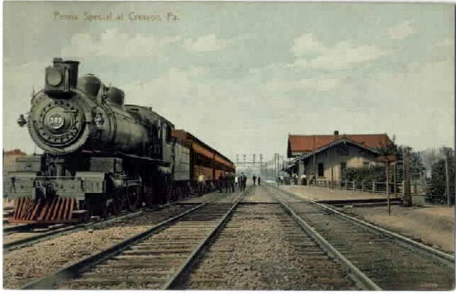
The Pennsylvania Special PRR at Cresson PA from an antique post-card view. Looking (railroad) north from Arch Street at the lead to the Black Lick Secondary. The Engine Terminal is behind the photographer. (98) "The passenger station at Cresson was located on the "downtown" side of the tracks between Front Street and #1 eastbound main. There were actually two buildings, one being the passenger station, and the other being the Railway Express Agency (remember the old REA green cars). There was a subway at the station on Front Street that allowed people to cross under the mainline and provided stairways to the two train platforms, one located between #1 and #2 eastbound mains and the other located between #3 and #4 westbound mains. The far side of the subway was a covered stairway that was located on the Arch Street side of the #5 main and the siding for the freight station. The location of the photographer was near where the old freight station was located on the west side of the tracks (Arch Street and Webster Hill)." Bill Nelson
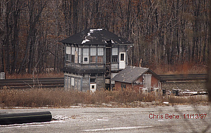
"MO" Tower, Cresson, PA, 1889-1998
"MO" Tower, at milepost 250.5, built around 1889, was located in the area of Cathedral Avenue and was demolished in 1998. You will note that the Blacklick Running Track (Cresson Running Track) is still in place with the exception of the steel girder bridge over the main. (It was removed in 1995 to increase clearances for double stack trains). Maps are available here.
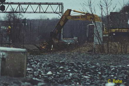
" MO" (Cresson, PA) Tower Razed: "MO" (Mountain) tower at Cresson had been vacant for several years due to the advent of fibre optic signaling. While traveling through Cresson on 12/7/98, I observed Conrail crews cleaning up the raised structure. This tower had served as a control point for trains operating between "AR" tower (Allegheny Ridge) / " UN Interlocking" (both located at Gallitzin, PA) and " SO" (South Fork) tower. A citizens group in Cresson attempted to save it and hired Earl Miller House-movers from Everett to attempt to have it placed at the park on Front Street and Keystone Avenue in 3/97. However, internal structural deficiencies were present, and on attempt to move, the tower started to collapse. It was not structurally sound. Cresson had prepared a pad for it along Front St., but the project had to be abandoned. (by Chris Behe and David Seidel; posted 12/28/98)
"MO" Tower. A telephoto view from Front Street. Looking (railroad) East. These images were taken on 4/96.
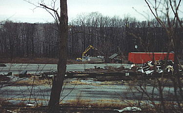
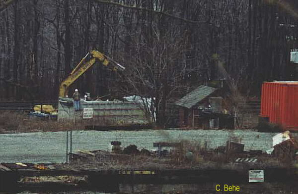
MO" Tower. Viewed from Front Street. Looking (railroad) East. These images were taken on 4/96. This photograph was taken on 11/13/97. Viewed from Rt 53. view of the MO Tower Demolition clean up.
Viewed from the area of Front Street, Cresson, PA on 12/7/98A telephoto view of the MO Tower Demolition clean up.
Viewed from the area of Front Street, Cresson, PA on 12/7/98A view of the cleanup taken from Rt 53. 12/7/98 A telephoto view of the cleanup taken from Rt 53. 12/7/98 Along Front Street, a park with a PRR NC5 caboose and train watching platform has been built. From here, you can view operations at the Cresson Engine Terminal (milepost 251.0). Here, diesels (Helpers) are fueled, sanded, washed, etc as the Altoona/Juniata Shop complex has no servicing facilities.
"The PRR track chart for the mainline, Altoona to Pittsburgh, dated 1958 and posted on "Keystone Crossings" web site shows a BF (brick freight) building on the west or Webster Hill side of the mainline at Cresson. The track chart also shows an FP (frame passenger) building on the east side of the mainline between track #1 and Front Street in Cresson. The track chart also shows the two passenger waiting rooms and platforms between eastbound tracks #1 / #2 and westbound tracks #3 / #4. Track #0 left track #1 south of "MO" tower, swung around "MO" tower, returned to run parallel to track #1 all the way to the portage tunnels in Gallitzin. A track from the lower yard crossed the mainline by way of "jump over" or "flyover" and circled the upper yard to join track #0. This allowed trains off the "Cresson" and "Irvona" branches to be received in the lower yard and dispatched on the eastbound mainline. Track #0 ran past "AR" tower, and under the Main Street bridge before returning to track #1. A siding left track #0 at the "high" bridge and ran all the way to "AR" tower before returning to track #0. The first signal bridge at "AR" tower spanned four (4) tracks (TRACKS #0, #1, #2, and the siding off track #0). The second signal bridge at "AR" tower spanned four tracks, also, but the siding had joined track #0 before reaching the second signal bridge. There was a dead ended siding off the track #0 siding and there was a dead end siding off track #0, also. There were cascaded single crossovers going left after the siding joined track #0 to allow all trains access to both tracks through the "Portage" tunnel. These crossovers ended before the "wye" track from the engine servicing facility joined track #2. There were cascaded single crossovers going right to allow access to the "wye" from track #0, #1, and #2. Helpers would cut off their trains and use these crossovers to reach track #2 where they would back down onto the "wye" to gain access to the engine service facilities and the westbound tracks to return to Pitcairn and start another push up the mountain. Helpers would also back down through the second set of crossovers and the "wye" track for service and turnaround.
They have relocated track #0 which used to leave track #1 south of "MO" tower and circle behind "MO" tower and run to "AR" tower where it again was connected to track #1. Track #0 now runs parallel to track #1 right over the sight of "MO" tower. The track from the lower yard which received the "Black Lick" branch crossed the main on the "flyover" and turned north in the upper yard to join track #0 for access to the eastbound main at "AR" tower. There was also a passing siding off track #0 that ran from near the upper yard connection all the way to "AR" tower. That is as I recall why the signal bridge at "AR" spans four tracks. A lot of trains used to sit on track #0 and that siding waiting their turn to take the eastbound main through the Portage tunnel." Bill Nelson
Photographs taken along Front Street
A view of the Engine Terminal from the Park along Front Street (1998)
A view looking (railroad east from the site of the old freight station in Cresson. 12-7-00 By Matt Fultz. Looking railroad (west from the Park along Front Street. (1998) A view looking (railroad) east from the site of the old freight station in Cresson. 12-7-00 By Matt Fultz. A telephoto view of the MLooking (railroad) west from along Front Street. (19_?_) By David Seidel
Carneys Crossing Carney's Crossing
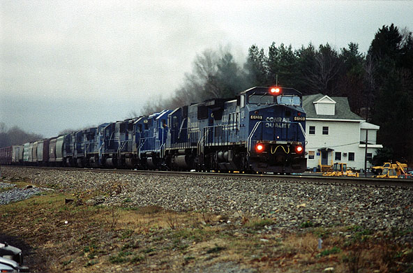
"A long mixed freight climbs the gradient at Carney's Crossing."
oubliettehoggle
Photographs are by Chris Behe unless otherwise noted.
Revised March 2015


